HUGE CHUNK OF UK TO BE HIT BY WINDS UP TO 55MPH FOR 15 HOURS
After a wet and windy start to 2024, we can finally expect a turn of drier weather, forecasters have said… but still pretty windy.
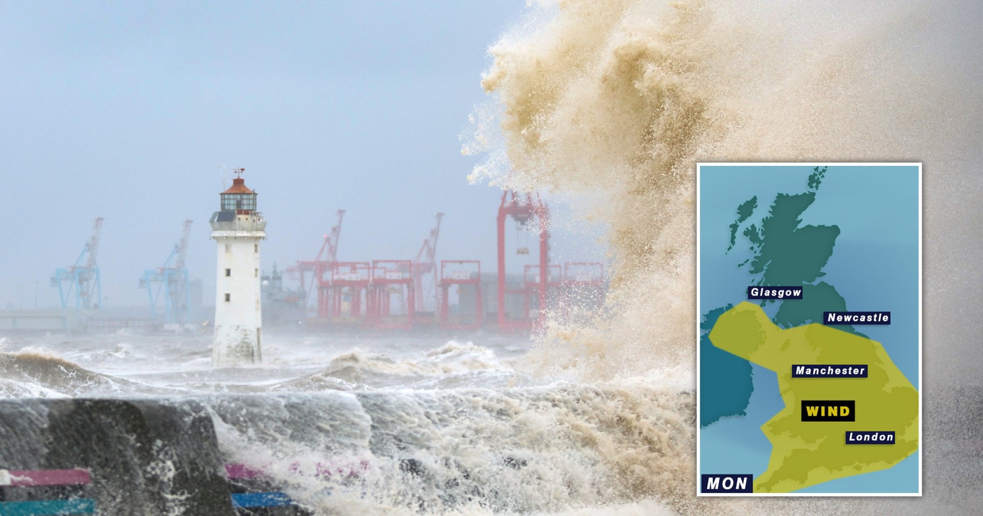
Very windy, actually. The Met Office has issued a weather warning for today that covers nearly all of England and the entirety of Wales and Northern Ireland.
The coast is set to be lashed by strong winds until 10pm, with winds as high as 55mph.
However, the national weather service says the winds will steadily ease later today. Inland will see gusts of between 40 and 45mph, the strongest where it is rainiest.
In Knutton, Stoke-on-Trent, locals say a ‘mini-tornado’ tore through the village that blew over a caravan, shook off roof tiles and
One resident told StokeonTrentLive: ‘Lots of roofs and cars were damaged. Police and the fire brigade have shut a road to stop people coming through.’
A yellow weather alert means that weather officials believe the wind will ‘likely’ disrupt your day.
Delays to road, rail, air and ferry transport are expected and power cuts are possible.
Today will be the wettest day this week as a band of rain pushes its way south-eastwards overnight, causing widespread rainfall across the country accompanied by strong, chilly winds, says the Met Office.
While not covered by today’s weather alert, Scotland can expect a few cold starts.
Early morning temperatures will sit lower than average, with early morning lows of 2°C or 3°C in Edinburgh and Glasgow.
Temperatures of around 8-10°C are expected across England through the day, with highs of 12°C and slightly warmer temperatures.
Met Office forecaster Simon Partridge said that in colder areas, such as northern Wales and Scotland, the showers may be accompanied by wintry winds bringing sleet and hail.
‘Monday is classic April showers really,’ he explained.
‘We’ve got a pretty windy day across the whole of the UK with gusts of wind up to 40-50mph pretty much anywhere across the country.
‘With that, we’ll have some quite blustery showers which will be slightly wintry in nature across the northern parts of the UK.
‘You could get a little bit of sleet and certainly some hail so it will be a much colder feeling day.’
The rest of the week is predicted to be drier and less windy, with showers in northern Scotland and parts of Northern Ireland on Tuesday.
In south and east England, it’s time to crack out the sun cream as sunny weather is expected.
Over the weekend, some areas in the UK enjoyed unusually warm temperatures, with the highest being 21.8°C recorded in Writtle, Essex, on Saturday.
This week, temperatures across the country are expected to reach the low to mid-teens with slightly warmer conditions in the south by Friday.
Lighter rain that has been seen across some parts of the UK will slowly move away towards the end of the week, making for a ‘mostly dry’ Saturday and Sunday nationwide.
Get in touch with our news team by emailing us at [email protected].
For more stories like this, check our news page.
Get your need-to-know latest news, feel-good stories, analysis and more by signing up to Metro's News Updates newsletter
2024-04-15T05:34:01Z dg43tfdfdgfd